Problem:
This school district was faced with the challenge of redesign their spaces to comply with new Covid-19 restrictions for student spaces. Their challenge was that they had paper drawings for all their buildings. They needed to update the drawings, ensure they were correct and scaled, integrate them into GIS tools to optimize the space layouts and enable virtual teams to collaborate on redesigning the spaces. =
Summary:
IndoorVu was rapidly collected data at 5 High Schools throughout the district. From the IndoorVu Intelligent Imagery, geospatial floor plans were generated and enhanced with 360 degree imagery. The data was loaded into the IndoorVu Portal, provided as CAD (dwg) files and as GIS (geodatabase) files.
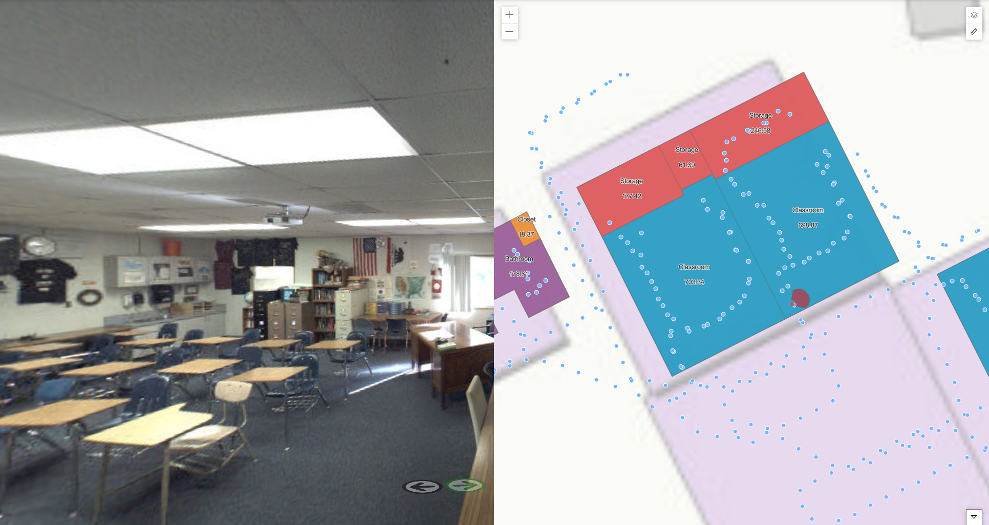
IndoorVu Portal. 2D Floor Plans, 360 Imagery
Result:
The School District was able to quickly stand up data and a standard workflow across all their High Schools to remotely reconfigure the spaces. They were able to seamlessly integrate their data into their existing GIS and CAD software tools. The 360 Imagery provided critical visual information about their spaces so that teams working from home could be effective.